
Trail Name: Little Annapurna
Distance: 15 miles, round trip
Elevation Gain: 5,200 ft
High Point: 8,440 ft
Trip Date: Aug 12th, 2007
Permits: Very restrictive over-night permits. A few are available by on-the-day lottery. See here for permit info. Day-use only permit available at trailhead.
Getting There: From Seattle – take Highway 2 east to Leavenworth. As you enter the town – turn right on Icicle Road. At 8.5 miles, turn left onto FR 7601 and follow it 3.7 bumpy miles to the Stuart Lake trailhead parking lot.
Read on for full trip report…
Background
Theresa was out of town one weekend last August and I found myself craving a Sunday day hike. I looked through the usual books – but couldn't find one that inspired me. I ended up near REI on Saturday evening and so popped in to see what books they had. I found Day Hike Central Cascades by Mike McQuaide. It's a good book, well written and more up-to-date than the old Mountaineers series collecting dust on my shelves.
I looked at the "Hikes at a Glance" section and for some perverse reason was drawn to the "Extreme Hikes" section. How did a moderate length 15 mile hike belong in this section? The start of the description that read "You must train for this one", also appealed to my sadistic sense of challenge. 15 miles, 5200 ft feet – no backpack – it can be *that* bad can it? I wanted to find out.
A brief nights sleep
This is a popular trail as it is the back way into the Enchantments area. I was craving a little solitude with my challenge and in general love being on the trail early. This one needed an early start. I left Seattle at 4am – with a 2hr drive ahead of me. Rather than the traditional Highway 2 approach, I took the I90 way around. I90 was weird at 4am – in several sections, I drove for 10 or 15 minutes without seeing another car – either oncoming or in my direction – it was a little creepy.
Trailhead
At 6:15 am I was on the trail at the Stuart Lake trailhead. Theresa had taken my car for the weekend, and I was left with her little VW bug – which doesn't have much ground clearance. The road up to the trailhead was brutal – washboards and potholes for 4 miles. Make sure you have a decent car than can handle it, or plan for a slower approach. On the way up, I noticed several people sleeping in trucks beds on the side of the road. It would probably have been smarter to drive and sleep the night at the trailhead rather than a 4am start.

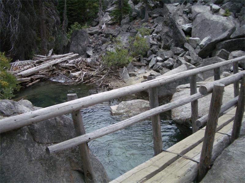
The trail starts in forest and follows a creek for several miles. At about 1.6 miles, the trail crosses over Mountaineer Creek on a log foot bridge.
The trail starts to climb from here and reaches a junction at 2.5 miles. It's 7:00 am now, and I'm getting nicely warmed up.
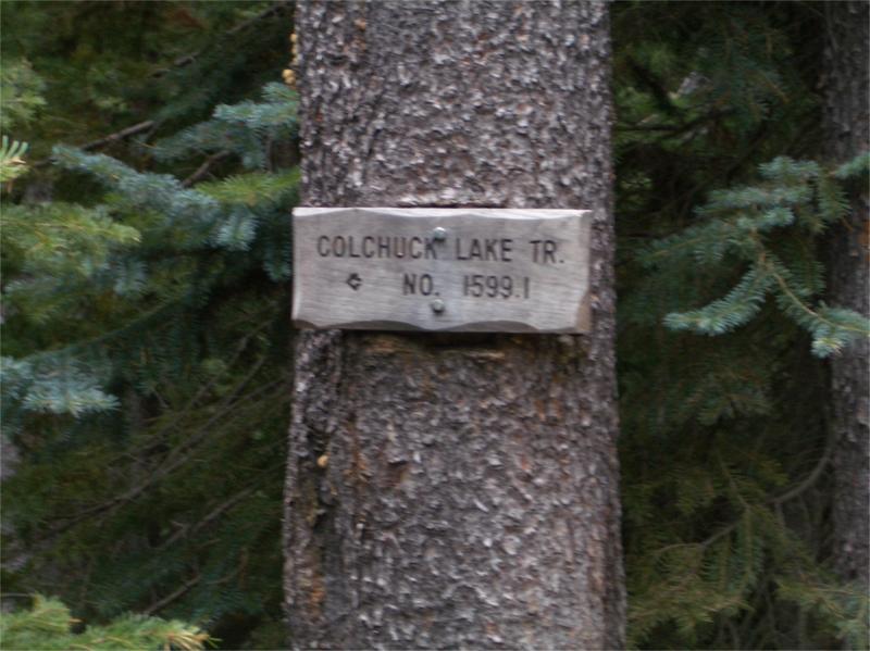
A signpost directs me to the left towards Colchuck Lake, climbing steadily up.
After another ten minutes or so, the trail crosses a creek again and then begins climbing at a much steeper rate now all the way up to Colchuck Lake.
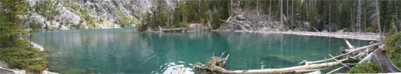
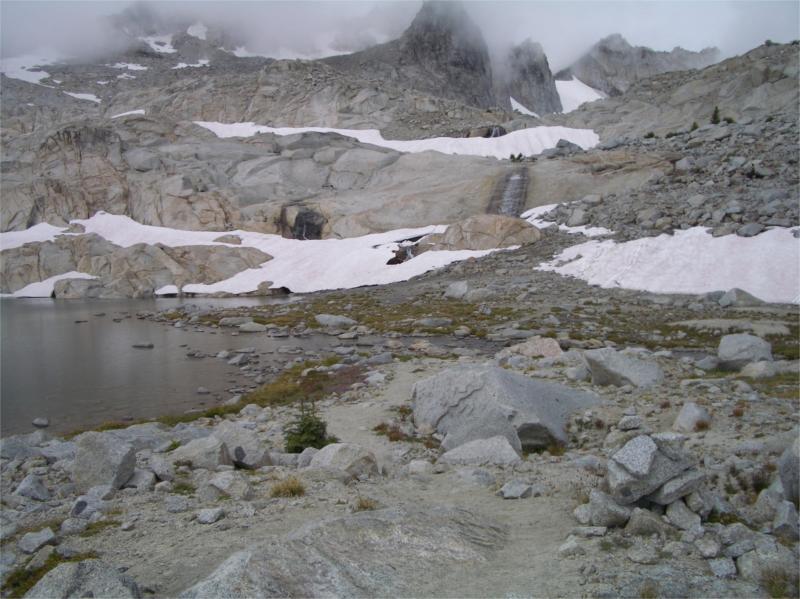
I arrived at the lake around 7:45am – there were several tents here with folks still sleeping inside. One camp was beginning to stir and the sound of a whisperlite stove was breaking the silence as I walked by.
At the lake, the trail goes to the right following the shoreline around. I found a creek here, and filled up a water bag – assuming I might need more for the climb up Asgard Pass and needed a good 45m for the chlorine dioxide to kick in.
Here is a a great shot of the topology so far. It shows the long hike in along the creek, climbing steadily to the lake, around the lake and the steep climb up Asgard Pass.

Boulder Hopping
At the far end of the lake, the trees break into an open area full of enormous boulders.

It was tiring to clamber over each of them, many stacks of cairns lead the way but it was easy to get lost.
After a while, I became quite proficient at using the carbon tips on my poles to make long jumps across rocks. It took a while to really trust the stab of my pole would hold on the rocks, but it soon became second nature.
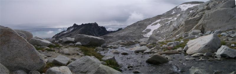
At 8:25 am, I arrived at the base of Asgard Pass.
Asgard Pass
Asgard is listed as an old climbers path, and is used by backpackers as a back entrance to the Enchantments area.

It's a steep path, gaining 2,200 ft of elevation in just under a mile.
The 'path' is a wide gully that is jam packed with large granite rocks and scree. There is no real path – only a way through the scree by following cairns along the way.
The only tips for this section of trail in the guide book are "veer left below a cliff band about a 1/3 of the way up" and "swing to the right near the top of a gushing creek 2/3 of the way up".
The views of Colchuck Lake on the way up are breathtaking here.

Half way up, I pass my first group of people – backpackers coming down from the Enchantments. They are surprised to see me so far up the trail already as I have no overnight-sized backpack – just a small day pack.
"Early Start?"
"Yup – I left Seattle at 4am"
"Hope you brought something warm – we had snow at the top this morning."
Snow? It's the middle of August!
Sure enough as I reached the top at 9:50am after an hour and a half of climbing – there was a very light flurry in the air. Not enough to form on the ground – but plenty of old snow to the sides of the trail in places. It was cold and barren at the top of the pass – out came the wooly hat and down jacket (I anticipated some cold). The top of the pass is 6.1 miles from the trailhead, and I still had a few more miles to cover with climbing to the top of Little Annapurna.
The Upper Enchantments
This topo-map shows the area quite well, you can see Colchuck Lake on the left and the traverse through the upper enchantments lake I must now make to get to Little Annapurna.

The Upper Enchantments are beautiful. Lakes everywhere. It's well above the tree line and feels like another world.

I follow the trail for a while, as it zig-zags around Isolation Lake and eventually starts veering off towards the sloping back of Little Annapurna. It's a very distinctive feature on the landscape and hard to miss.
I meander over waterfalls and across snow fields, and quickly loose track of the cairns.
The trail is easy going in places, but hard in others. I get trapped into one region and have to do a little scrambling to get over some rock walls. I muse to myself that this type of activity probably isn't smart when solo hiking, and I should have been more cautious and followed the cairns.
Eventually I meet up with some cairns again and start climbing up the back of Little Annapurna. The weather quickly changes and begins to rain. Out comes the Umbrella and I trot along climbing up slabs, not another sole in sight.
At 11:20am and 7.5 mi – I finally reach the top of Little Annapurna. Here's another Topo View where you can see the Enchantments in the background. Note the big drop-off at the edge of Little Annapurna.

Here's what the guide book says:
"The views here are huge and far-ranging in all directions. Ingalls Creek winds its way down in the valley 5,000 ft below. On clear days views range from the South Cascades (Mt. Rainier and Adams) to the North Cascades (Mount Baker) and seemingly everything in between. To the north, the Enchantments Lakes basin in spread out before you – a true lakes-peaks-waterfalls feast for the eyes."
It sounds spectacular. Sadly not for me – the weather closed in fast on the last stretch and I barely had 20 ft visibility. It was cold and raining hard – a sleety mix. I sat on my jacket Umbrella in one hand, and a Peanut Butter & Ham sandwich in the other and devoured my lunch.
I didn't linger long, as the visibility was getting worse, and I needed to navigate my way back to the pass.
At 11:30 am, I start my descent down.
Once I got down off the shelf and back in to the Upper Enchantments, the weather got a little better. The cloud lifted and the rain eased to a drizzle.
I was moving at quite a speed going down Asgard Pass, and the rain started up again. The rocks were slippery and I took a few minor falls. One of them shredded the elbow of my Golite Helios jacket – and left many holes in it. I'll post my repair notes one of these days.
After getting to the bottom of the pass, and crossing the lower boulder field again – I was back at the lake shore. I was starting to get somewhat fatigued at this point, and stopped for a quick rest and to splash my face. Amazingly the rain stopped and the sun came out! Talk about varied weather conditions for a day hike!
The rest of the trail went quickly and I was out by 3:05 pm.
5 hrs up and 3 1/2 hrs down.
Did it deserve the "Extreme" rating? yeah… it was a tough hike. I hobbled into work the next day feeling a little sore. My feet were most sore from the impact on all the boulders.
A great hike – I'll try and do it again next summer and get some of that view I was supposed to see.
Good post Brett. What do you use for topo software?
Hey Frank – I’m not sure I can disclose that yet 🙂 It’s something that is being developed by a friend. I’ll ask for his permission and see if I can post a link to it.
I too am always impressed by your maps. The topos in this particular trip report are superb! Wonderful description and photos as well, Brett. Thank you.
– Sam
Brett, thanks for the great post and graphics. I was in WA two years ago and hiked Mt. Pilchuck, a sweet hike. I plan on returning from New York to day hike Little Annapurna..maybe this August if i can work out the details….it appears that snowshoes or crampons aren’t needed in August.
Barnes – I would say – no worries on the crampons in August… but this year is a record setting snow fall. If you’re thinking early August I would check w/ the ranger station a few weeks prior just to make sure.
Very cool hike! I usually do the Mt. Stuart trailhead to the Snow lakes trailhead but this year I’m doing this hike. Even better views and an easier finish. Assuming, that is, that I get down Asgard in one piece! You must have been cruising though because the times you list are pretty brisk. I may just be a wienie though! Great report, it is such a beautiful place!
Pingback: Brett on Stuff » Trip Report: Spectacle Lake, Glacier & Park Lakes–Day 2
Just wanted to say how well you laid out the trip with concise comments and great pics. Your whole presentation has a nice feeling to it. Thanks
Great pics! I found your site after hiking to Colchuck Lake recently, and wanting to send people some info and talk them into doing the same trail.
The maps are FANTASTIC!