Category Archives: Trip Reports

Trip reports and trail guides.

Devils Loop– Photo Trip Report

Trail Name: Crater-Jackita Ridge-Devils Loop Trip Report
Distance: 43-ish miles
Date of Trip: September 20-22, 2011
Permit Info: An overnight permit is required but can easily be obtained at the Methow Ranger District.
Getting There: From Seattle, take I5-N, then Highway 20-E towards Winthrop. Ample parking at the trailhead a few miles after Ross Dam.

Trail Map:

Map from 100 Classic Hikes in Washington

This trip report is going to be a little different – normally I include all the excruciating detail; however – on this trip I decided to keep on my notes in my iPhone vs. my usual pen & paper method; and ended up killing my phone. The trip was almost 6 months ago and I have the memory of a goldfish, so I can't recall all the details.

However, my friend Tim took some great photos that are just too good not to share so here goes a quick photo-trip report.

Overview:

This trail covers 40+ miles of spectacular terrain dipping into the lonely and vast Pasayten Wilderness in northern Washington. We took it anti-clockwise starting with a big climb up to Crater Lake and heading north to Devils Pass. From here you can do an extended loop (90m or so) by going north, but we only had a few days and so opted for the shortcut west across Devils Dome and a very flat hike out along the lake shore.

Day 1:


Old ruin near ruby peak


Crater Lake (more like bug-pool)


Logging notes in my phone


The elusive Pickett Range

Day 2:

Someone carried that thing up HERE?


My favorite trail lunch


Vast meadows of the Pasaten


Jack Mountain


Pretty Lake & Waterfall


Long Rubble Decent


Lenticular clouds. Spells Trouble! Miles and miles from nearest roads Collapsed Shelter Only water source was a rusty pipe "spring"

Day 3:

A wet start


And so started day 3. It dumped on us all morning with brutal wind. Our cameras didn't come out after this. Devils Done was rough – the umbrellas had a tough time in the exposure and sideways rain, so the waterproof jackets had to ensure most of it. By the time we reached the shores of Ross Lake for our camp site, it was still somewhat early in the afternoon. Faced with a soggy night, we opted for a hike out. We came out by headlamps after an epic 24 mile day.

I made the mistake of taking new shoes for this trip and not replacing the insoles with super-feet. The stock inserts were awful when fully saturated and hiking hard and kept folding up uncomfortably. I won't make that mistake again.

Trip Report: Spectacle Lake, Glacier & Park Lakes – Day 2

Day 2 Map:

Lazy Bones

It's not often that during the night I cinch up the string of my sleeping bag hood to barely a pinch-hole. Last night was one of those nights, but not because of the freezing temperature, on the contrary, it was a warm and mild night. I was hunting for darkness – it was bright & sunny all night and the light was waking me up. Too sleepy to question the ridiculousness of my logic, I closed that hood and fell back to sleep. Next time I awoke it was 9:30 am. I can't recall ever sleeping in this late.

I got up and went to reclaim the food bag while Tim started boiling water. Not surprisingly the two other parties camped at the lake had already left. After a quick coffee and breakfast of cold granola and coconut milk we packed up the tarp tent, which had minimal condensation this morning.

Loo with a View

It's worth mentioning that the toilet at Spectacle Lake has probably one of the most spectacular views of any wilderness toilet. Here's my throne  picture for the day:

My only complaint, is that they didn't orient the toilet in the right direction to fully appreciate it.

GoHeavy

Climbing up out of Spectacle we passed by one of the solo campers from last night. He was carrying a serious rack of camera gear, including a tripod that look like it weighed 20 lbs alone the irony of the situation is that a lot of it was crammed into a GoLite  backpack. He was probably hauling 40+ lbs in there. I hope he got some great shots.

Annapurna Debate

We started the climb up to Park Lakes the views opened up to some very expansive Vistas. In the distance, a very prominent feature was Mt. Stuart. We tried to make our where Little Annapurna was in relation and guessed it to be on the left. Wrong. Tim whipped out his iPhone and used a nifty little application called Peak Finder; which uses the GPS and doesn't require a mobile signal.

We quickly confirmed it to be on the right. Peak Finder was really fun, and we used it on a lot of the views.

We kept climbing and crossed a few minor snow patches on the trail. Passing an occupied horse camp on the way.

Park Lakes

Our first stop for the day was to Park Lakes, we planned to spend the night there, and so were going to setup our tent and drop off a little gear before making the trek to Glacier Lake and beyond. We picked the smallest of the lakes, as it seemed nice and cozy and very swimmable should we get back in the early afternoon.

Glacier Lake

We we climbed higher on the PCT from Park Lakes the views kept getting more and more epic. Eventually we came across a junction with a smaller trail leading off in the direction of Glacier.

The trail climbed but was wet due to a stream more or less running down it. Patches of snow on the trail got more common as we crested the top. Down below us we could see the pretty looking Glacier Lake, complete with blue-glowing glacier off to the right. However, the trail down to it wasn't so easy. For a while the trail followed a steep gully with fairly good steps down, then we hit a large snow patch. The snow veered off – very steeply into the gully, it appeared to be the natural path, but the fall line took us right over a steep drop that we couldn't see the other side of. To take this path would be very foolish. Rather we traversed across the snow patch trying to get to bare ground to find an alternative route down.

We made around to see where the trail was – but it was hard to spot, and appeared to be now a stream due to the quickly melting snow above it. Far below, we got a good view of the road ahead to Glacier Lake. It didn't look good. A large body of water with falls above it was melting out and creating the large waterfall we saw dropping into Spectacle Lake last night. The water was covered in snow bridges and it was unclear how safe a crossing would be. A fall through one of those bridges could be fatal. We debated for a while on how adventurous we were feeling and eventually decided to take the conservative option. We bailed on Glacier in favor of a hike higher up on the PCT. A lake's a lake, and Glacier would be there next season.

On the way back up the Gully, we ran into two backpackers going down to camp at Glacier. We gave them our trail beta and told them we were turning back, but they seemed adamant to try and alternative path down. They said last year they bushwhacked to Glacier all the way from Spectacle, which would have been quite the adventure. We wished them well.

Up the PCT

Back at the junction, we turned left onto the PCT and hiked a series of long switchbacks in the hot sun. Tim took this fun Action  shot trying to blur my motion and keep the background steady. It ended up almost the opposite, but it's fun how it turned out.

Eventually coming to a high point on a corner, our turn-around spot. The views were outstanding, down to Park Lakes on the left.

and meadow views to the right, where one could see the trail weaving around the mountainside towards Snoqualmie pass. We must have been only 5 or 6 miles from Kendall Katwalk.

While playing with Peak Finder on his phone, Tim noticed he got a signal out here. I guess as the crow flies we were pretty close to I90, but it felt like a long way from civilization. I tried making a quick call to Theresa to say hello to the boys. Alas, voicemail.

Twins?

We turned around and tore back down the hill at a pretty quick pace. About half way down to the lake, we heard the roar of a fighter jet and looked up to see two of them upside down. Upside down? Yup they completed their barrel roll as they flew overhead. Fun little air-show, just for us.

Of course, you can't witness a barrel roll and not mention the legendary roll of a Boeing Jetliner during the 1955 Seattle Sea Fair. So we yakked about this for a while as we continued to few miles left to camp at Park Lakes.

Camp Photos

It was 3pm, which was a little early for bed, so we took a nice dip in the lake to cool off. Behind the lake was a beautiful copper colored stream which seemed to drain towards Spectacle. It was our source of water in camp.

We ate an early dinner and hung the food. Admiring our almost text-book PCT-method  hang:

We spent the early evening wandering around and exploring the lake, and Tim took some amazing photo as the light turned.

Around dusk the bugs turned nasty and we had to break out the head-nets. There were very large swarms of mosquitoes all over us, but as soon as the sun was down and the temperature dropped, they were almost non-existent.

I set my watch alarm for an early start – 6am – so we could burn most of the 13 miles out before lunch time.

Spectacle Lake, Glacier & Park Lakes – Day 1

Trip Report: Spectacle Lake, Glacier & Park Lakes – Day 1

Last week, Tim and I took a spontaneous mid-week 3-day backpacking trip in the Alpine Lakes area of the Cascades.

Due to an unusually high snowpack this year, we struggled to find the perfect spot for our 3-days. Many of the epic trips we wanted to do were still suffering from high-elevation snows which would mean we couldn't do the mileage we wanted in our allotted time. An excellent compromise, very close to home – was Spectacle Lake and beyond.

Trail Name: Spectacle Lake, Park Lakes, Glacier Lake, PCT

Distance: 30-ish miles

Date of Trip: August 24-26th, 2011

Permit Info: An overnight permit is required but can easily be obtained at the trail-head. This is a crowded area on weekends, so go mid-week or expect to fight for camp spots.

Getting There: From Seattle, drive I90E to Cle Elum, then drive Hwy 903 for 18 miles. Turn left on Forest Road 46, crossing the river and after 3 miles turn right onto a gravel road – following signs for Cooper Lake. Pete Lake trail head is here, people parking on the left, horse parking on the right.

Trail Map:

Map from Backpacking Washington.

Green Trails Maps: #207 and #208.

Photo Credits: The crappy ones are from my iphone, the awesome ones are Tim's.

Day 1:

Checking the scale before we left, my pack was coming in at just under 19lbs with water and 3-days of food. Tim was running a little heavier as he was packing in his Canon 5D for some spectacular shots.

We left Seattle at a nice leisurely 9:30 am and arrived at the Cle Elum Ranger Station around 11. We wanted to check-in on trail conditions and also needed to buy another NW Forest Pass (after leaving mine on the kitchen counter!). The Ranger told us that he pretty much just checks the WTA website these days for trail conditions reported by hikers, as they don't have many field-rangers anymore to keep up on conditions.

Another 30 minutes or so and we were at the Pete Lake trail head, close to the shore of Cooper Lake. It was a Wednesday, and so there weren't many cars in the parking lot, so the mozzies smelled us a mile away. As soon as we got out, a couple came right up to introduce themselves

We read some recent reports that mosquitoes were very bad in this area, so defended against them with Permethrin treatment on our clothing.

To Pete Lake

The hike starts out with a very easy 4 mi hike in to Pete Lake. The trail hugs Cooper River, which reveals itself at various spots along the way – the river had a very pretty copper-blue tone to the riverbed that made you just want to run down the bank and jump right in.

Other than a few junction off-spurs on the way, a couple on horseback and a few hikers coming out, it was a fairly uneventful trip to Pete Lake.

We ate lunch on the shore of Pete Lake – I munched down my usual Day One , PB&J and fresh apple with a little beef jerky. Delicious.

A Wet Bushwhack

A sign at the trailhead warned us that the PCT bridge had washed out and the only option was to ford the creek. Some WTA reports suggested there was a tree down near the bridge that was crossable, but we decided to just do the ford anyway.

Rather than just jump right in, we scouted the bank for a drier option. There appeared to be some cairns marking the way towards a large downed tree. Unfortunately the tree turned out to be inaccessible and the cairns stopped short to another bank, they probably marked an earlier season crossing when the main crossing was too fierce. Foolishly we decided to take the freshly discovered alternative crossing.

We pulled out our socks and insoles (to allow shoes to dry faster on other side) and waded in with our shoes on. The stream was over knee deep in spots, and flowing fast, but fairly easy to cross with poles. However, when we got to the other bank – we had to take a pretty extensive bushwhack through nasty thorny bushes before we were back at the trail. Added an unexpected 20 minutes to our crossing.

On the other side, I re-applied Hydropel to my feet to prevent blisters and put the dry socks on and insoles back in, within ten minutes of hiking the shoes were dried out again. This is a huge advantage for non-goretex light mesh style trail runners – they dry fast.

Zen and Forest Fires

After the crossing the trail weaves through a burned out section of forest and them began climbing up to Spectacle Lake. 

As we hiked though this section Tim has a Zen moment: he noticed that the hard-worn trail we were on had very aggressive growth at the sides. The trail (or wound), allowed there to be more light which allowed for more intense growth to heal itself.

The trees quickly regained their foliage and the trail opened up to pretty meadow views and crossed a foot bridge by a large waterfall.

On our way up to the Lake we ran into a Spanish PCT thru-hiker – he was almost running down the hill. He noticed my ULA pack and stopped to chat. He was also carrying a ULA and was curious what pack Tim had (GoLite Jam). Sixty seconds later and he was on his way, cruising rapidly downhill clocking the miles before bedtime.

The trail finally spurred off towards Spectacle. As you can see in the picture below the lake is almost divided by a long peninsular. When you get to a fork in the trail go left and around the lake to get onto the peninsula; these appear to be the best camping spots. We arrived around 4pm.

We setup the tent and explored the area for a while. The temperature was pleasant and the bugs were minimal.

Not that hungry, we eventually forced ourselves to cook our freeze dried goop and chow down a meal.

Hung the food and tucked up in bed by 8pm ready for a big day up to Glacier and Chickamin Lakes tomorrow.

Spectacle Lake, Glacier & Park Lakes – Day 2

Wonderland Trail Trip Report – Day 7

South Puyallup River -> Mowich Lake

Total Distance: 21.7 mi
Date: 9/5/2009

Indoor Swimming Pool

I woke up around 6:30 to the feel of wet feet. It rained hard in the night, and the area we pitched the Tarp Tent was not a good one. A huge puddle of standing water formed at the bottom of the tent and because I have a 1st generation Cloudburst without the bathtub floor – it overflowed the ground sheet and came a few feet into the tent. With a lightweight down sleeping bag, this would have been unfortunate. Luckily for us – we were planning on being off the trail tonight – so it didn't matter too much.

Continue reading

Wonderland Trail Trip Report – Day 6

Paradise River to South Puyallup River

Total Distance: 14.6 mi
Date: 9/4/2009

minimap-day6

A Stir in Camp

The morning started average enough. Wake up, go for a pee, get the stove going start to make breakfast etc etc. That is, until Dave decide that it would be a brilliant idea to accidentally knock his cup over, next to the wasp nest entrance – and watched it tumble into the opening.

Almost every wasp in the nest decided to come for a little visit to see what the commotion was. We backed away and kept a little distance. After five minutes or so, they decided that Daves cup wasn’t a big threat and slowly started flying back into the nest. Whew.

Continue reading

Wonderland Trail Trip Report – Day 5

Maple Creek -> Paradise River

Total Distance: 7.4 mi (10.6 mi Unofficial)

A Soggy Start

The rain slowed to a trickle in the early morning so we hopped up and took advantage of the lull to grab some breakfast. The toilets were so overflowing in Maple Creek that we decided not to contribute to the problem and broke out the trowel and set up camp  in the nearby clearing.

After packing away the soggy tent, we broke camp around 9:30.

The trail started out innocent enough – traversing Stevens Creek in the woods. Soon we came across badly conditioned sections of the trail – lots of washouts and erosion from flooding with make-shift paths around.

The overgrowth was wet and made for a soggy morning stroll. We powered on and soon put the easy miles to the lakes behind us. The trail crossed the road several times on the way to Reflection lakes – with the occasional car rolling by.

At Myrtle Falls a bridge was out and a big tree had been felled to create a temporary bridge.

Continue reading

Wonderland Trail Trip Report – Day 4

Indian Bar -> Maple Creek

Total Distance: 10.0 mi

A Nibble Free Night

We woke up at 6:30 to a full view of the other side of the river from the missing wall of the shelter. Phew – we made it through the night without getting pooped on or nibbled by mice.

I stepped outside to assess the situation. Given the low cloud and changing weather in the evening I thought we might be in for a rough day. Outside the shelter at first the skies seemed grey, but as my eyes adjusted to the light I realized that they were crystal clear and blue and the valley was out in all it's glory. It was going to be a good one.

Continue reading

Wonderland Trail Trip Report – Day 3

White River Campground -> Indian Bar

Total Distance: 10.2 mi

Ready to Rumble

Refreshed after our long half-day rest, we got up early and were treated to an excellent alpenglow on the mountain as we tucked into breakfast. After cleaning up and packing, we hit the road around 7:50 am.

Finding the continuation of the Wonderland Trail was a little tricky – turned out it was on the other side of the car camp ground close to a toilet block.

There was a big tree chopped down over the river with a branch-made handrail for us to cross over. After the crossing – the trail out of White River was more or less level for a while and them started up a very sustained climb to Summerland.

Continue reading

Wonderland Trail Trip Report – Day 1


Trail Name: The Wonderland Trail

Distance: 93 mile loop + Side Trips

Elevation Gain: 22,000+ ft

Date of Trip: August 30th, 2009

Permit Info: An advanced permit/reservation is required, although a limited number of permits are reserved for walk-ins. Applications can be made around mid-march each year. Permit information here.

Getting There: There are several routes into Mount Rainier National Park. Depending on where you decide to start your trip – you should figure out which ranger station you plan to pick up your permit from. A permit reservation letter will be mailed to you before your start, but you need to use this to pick up your permit before 10am on the start of your hike, otherwise your slots will be given away to walk-ins.

Trail Map:

Map from National Park Service.

Don't forget to click on the thumbnails to see larger images!

The Backpackers:

For this trip – we had a group of four – Nigel, Tim, Dave and myself. Tim, Nige and I did the Pasayten together last year and since then Nige completed the TGO in Scotland to hone his Ultralight skills (Or develop some contraband habits as we'll discover later ). Tim was a good sport spending a week with three brits. Dave was the newcomer and showed up to Nigel's house the day before with a five pound sleeping bag that more or less filled the entire Jam backpack Nigel lent him. Fortunately, Nigel has a gear surplus and was able to kit him out to be in the ballpark. Our start packs with 5 days of food and full water, weighed in at 23lbs (Brett), 25lbs (Nigel) 26 lbs (Tim), and 27 lbs (Dave). Dave scoffed at our running shoes and opted for more sturdy boots without poles as he had a shoulder injury and didn't want to impact it too much.


tim-150

Tim Ahlers


brett-150

Brett Marl


nigel-150

Nigel Ellis


dave-150

Dave Nettleton


Mowich Lake -> Mystic Camp (13 miles)

Continue reading

Back from Wonderland

We're back! We had a stunning trip on the trail. Thanks to Tim lugging his huge SLR around the trail – we ought to have some excellent photos to show also once he processes (digitally, in lightroom) them. A big storm is heading for Rainier this weekend – with 1-2 ft of snow down to 6,000 ft. Trail-finding in snow around Klapatche didn't sound much fun – so we compressed the last few days and got out 2 days ahead of schedule. The trail was spectacular, every day brought something unique and different. Including a few side trips – we figure we cleared over 100 miles and about 24,000 ft of elevation. I definitely want to go back and section hike some of the areas that we're socked in due to the storm yesterday – but they we're still pretty none the less. Oh – and I think my teeth are stained from all the blueberries I ate. 🙂

I'm looking forward to going over the notes and writing up a trip report in the coming weeks…

East Pasayten Loop Trip Report – Day 4

It was 4am and it was cold. My watch was reading 38 degrees in the tent – chilly when you consider the daytime was in the 80's. 

It was a rough night; and my sleep pad felt thin – I forgot to take my usual nighttime dose of Tylenol PM before hanging the bag for the night. I shut my eyes and tried to get back to counting sheep, or mountain goats maybe.

Eventually 6am came and the sun came up brightly through the trees and started to warm things. We expected to have a cold breakfast as we thought the sun would come up late – hidden behind Amphitheatre Mountain, but it rose perfectly between the saddle and hit the campsite early.

I got up to warm a little in the morning sun, and got some coffee going. The bugs weren't bad this morning, so it was nice and pleasant sitting out on the rocks.

We ate breakfast, did camp chores and then spent a while doing extensive foot repairs. We debated if the best option for my now liquid filled blister was the lance the skin and drain the fluid or not. The fluid supposedly serves as nature protection – but it sure makes things feel less comfortable with a swollen bulge in your shoes. We decided to leave it intact at least for now. Plenty of duct-tape and gauze later and we were all ready to roll. Nigel and Tim were sporting some new foot-sores now too – so they deployed some preventative measures of their own.

Just before we left camp, my satellite pager went off. My heart fluttered with fear. Surely Theresa can't be going into labor we're too far from the road to evacuate in any reasonable time. I checked the message and it was indeed from Theresa – but just some sweet words of encouragement. It was a cute to get messages from her on the trail – kind of like being in primary school getting little love-notes passed from another classmate with a crush; but also weird to receive them one-way and not be able to text-back.

We left camp around 8 am and decided to take a ˜shortcut' to Remmel Lake that was marked as hard to follow  on the Green Trails map. We went off in search of the shortcut.

The ˜hidden' trail was rough going at first – not that it was hard to find, but it wandered through a marshy area with heavy horse damage on the trail – so there was deep unpleasant mud to walk in. After a while, the trail did start getting a little trickier as we climbed up into a rocky area with little vegetation. It looked like one could do a neat side-trip here up into a saddle that appears like it would look down into the Amphitheatre. However, we elected to continue on.

Eventually we re-found a trail and it popped us out into a stunning meadow area, with breathtaking views all around. A small stream ran through the base of the meadow and I broke off from the group for a while to get water from the stream. Walking back towards the group, I realized that the ˜grassy looking meadow' I was in, was actually thick with flowers with green-buds on just waiting to bloom. We were a little ahead of the curve due to the late snow melt, but I sure wish I could have seen this area in full bloom. Still – it was very pretty as it was.

Further on from the meadow area we walked into an area with what appeared to be a somewhat permanent camp. There were white tents, a propane tank and a fuel drum. The camp seemed still – and a deer was munching grass on the other side of it. We assumed perhaps the trail-maintenance crews stayed here?

The trail descended rapidly until it dropped us out near Remmel Lake around 9:30am. Remmel Lake was wide open and very expansive. Plenty of horse damage here, but pretty none the less. There wasn't a sole in sight during our time there. I kept peering over the other side of the shore – half expecting to see some a bear or other large wild-life – but it was still as could be.

As you leave the Remmel Lake area there is a very tight hairpin turn off to the left – which is easy to miss; which is the trail leading down to the Junction to 4 point lake. The decent was long, and pounding on the feet. In true Tim style – he decided he would ˜jog' (more of a ˜sprint' in our book) down the trail and meet us at the junction. He gained a good half-hour over the rest of us by the time we caught up with him.

In Tim's absence, Nigel and I debated on what we wanted for lunch. Cheese Crackers and Salami won out again – and our plan was to snack at the junction. Half way down I  had a bright idea We stopped in a chilly stream and filled up a left-over foil pouch from a freeze dried meal last night with water, and plopped the cheese and Salami (Vacuum sealed) in it. This was my trail refrigerator  and had a good 35 minutes to get the cheese nice and cold for lunch. Sure – it meant carrying an extra pound of two of water – but our packs were very light at this point in the trip.

We caught up with Tim and ate lunch – out came the head nets – as lower in the woods the mozzies and biting flies came out – obviously attracted to the delicately chilled Aged Cheshire Cheese on the menu.

It was only 11:30 am and we had a choice to make:

  • Climb 2.5 miles or so and camp at four point lake for the night, at the consequence of a long 16 mile last day out.
  • Or continue on another 8 miles to our first camp, followed by a short 5 mile half day out. 

It was tough call – four point was supposed to be very pretty, but it was really early in the day still. The long last day didn't appeal either.  We decided to skip four point and push on to the first camp.

The eight miles along the Chewack valley were long and gradually descending. We arrived at camp around 3:30 pm. My blisters were burning and so I went to dump my feet in the stream to get some relief.

Nigel, Tim and Bill started the next debate

So it's only 3:30pm – which is pretty early in the grand scheme of things  (uh oh a very slippery slope)

We had a few more options to consider:

  1. Stick around and setup camp for the night.
  2. Bust our asses on the last 5.2 miles out of here and car camp at the trail head.
  3. Option 2, except drive home stopping for junk food on the way.
  4. Option 2, except head to Winthrop for celebratory Margaritas at the Mexican place and then drive home. 

We spent a good hour debating our options and repairing our feet. We'd used up all our duct-tape on blisters and were down to just a few plasters. At 4:30 we took the final poll – each of us first a first and second choice vote. The votes came out 2,0,2,4 in favour of Margaritas! So on went the packs and out came the polls.

The push out was hard work – it had been a long day so far – over 16 miles to the camp site, and we were adding another 5+ to get out. We forgot how unmaintained this section of the trail was – but seemed to brute-force our way under and over fallen trees with a feverous vigor! The power of the mighty Margarita promise!

Two hours later, at 6:40pm we arrived at the bridge we started the trail on.

This time the trail head was not empty – a forest service truck was there, and two frogmen were swimming in the river in dry suits. They were surveying fish – and had found Chinook Salmon, Rainbow and Steelhead Trout swimming upstream. We chatted with them for a while while we washed up in the river before heading for civilization and tequila.

[Apologies for the long delay in getting this written up. A newborn sure takes a toll on ones time to be able to write blog entries!]

East Pasayten Loop – Day 3

East Pasayten Loop Trip Report – Day 3

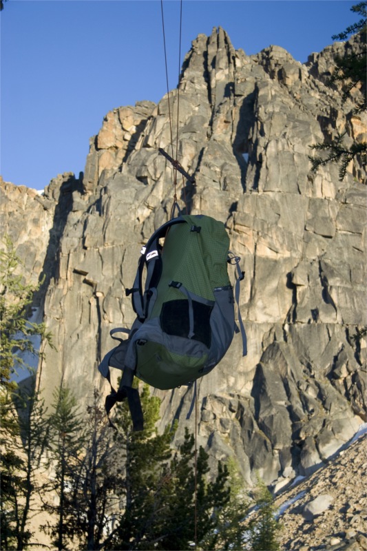
Day 3 was an abrupt start. Around 5 am – as the sky was lightening I heard a shriek from Nigel, muffled by my earplugs- "Maaaattee – wakeup – there's a mouse under your hat". Sure enough, a little field mouse had found enough of an opening in the zipper of the Tarptent that we left open to allow a platy-hose to supply water in the night.

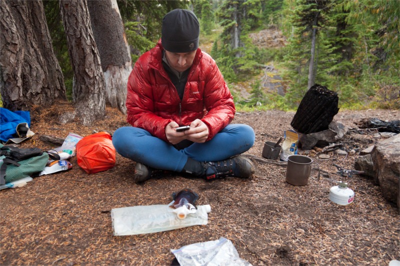
Breakfast was another hearty Swiss Muesli with coconut milk – spiced up with some de-hydrated raspberries that Nigel's wife Lynn made for us from her garden. They were perfectly tart! We also drank a bunch of Chia Seeds to see if the extra fuel would help us get going.

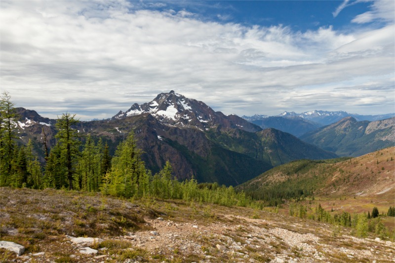
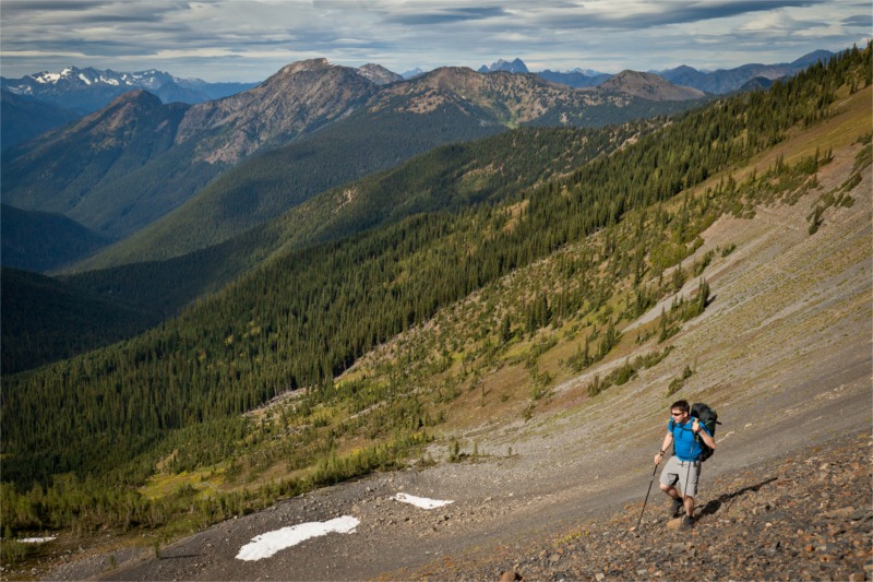
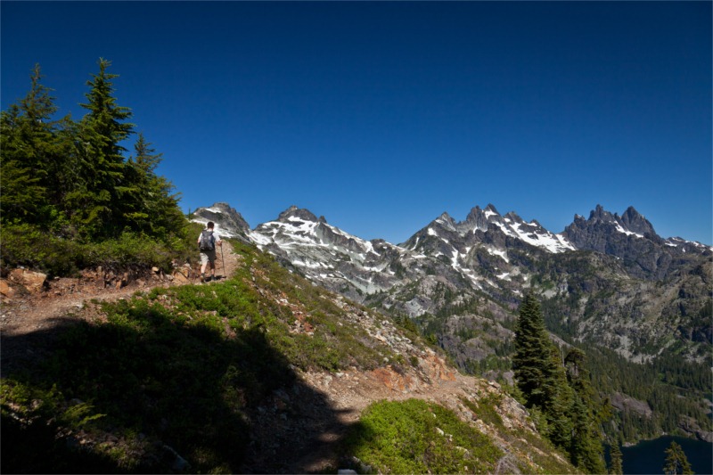
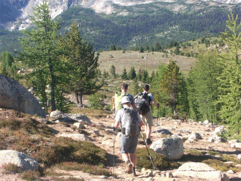
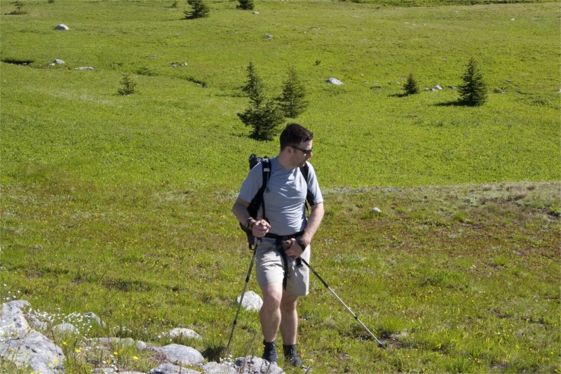
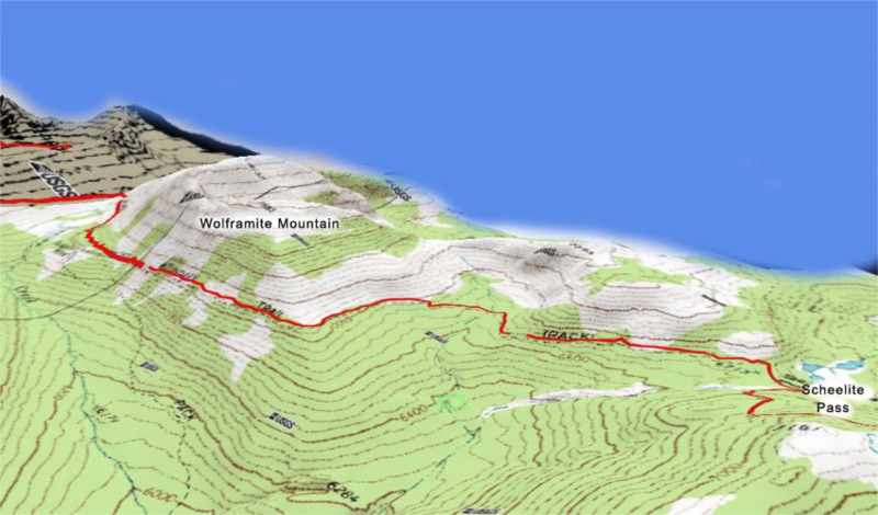
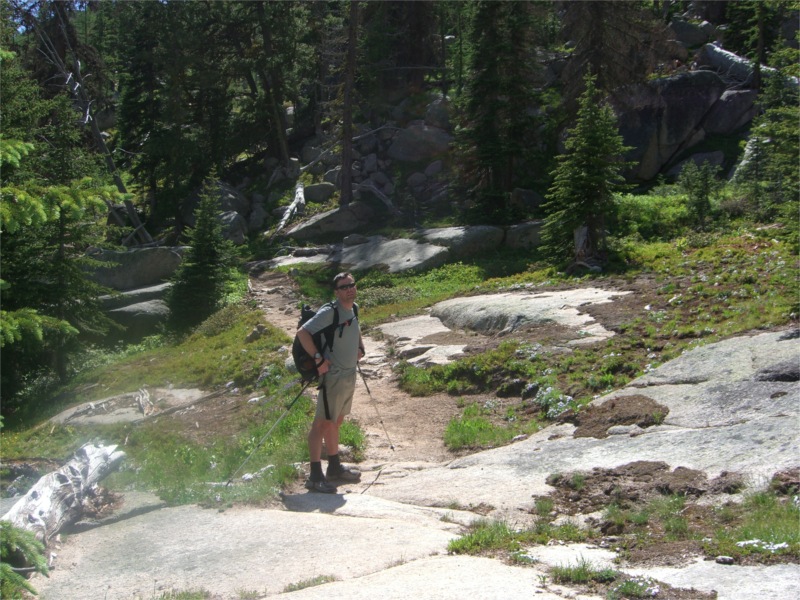
We were on the trail by 8am and my blisters were already very sore. Boundary trail continues past haig mountain, around teapot dome for another 7.2 miles on the way to Tungsten Mine. There were plenty of meadows and larch trees and ever-improving views along the way to keep us entertained.

On the other side of teapot dome we found a great looking unmarked campsite with good water sources.

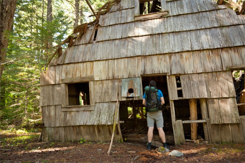
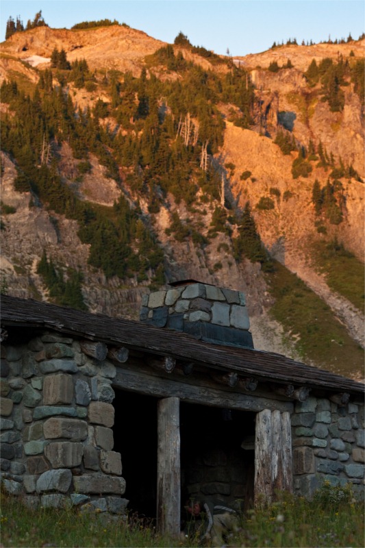
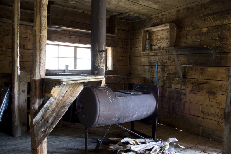
After several hours we finally arrived at Tungsten Mine.. There were a few clues we were near the mine – a stream crossing the trail with some rusty iron pipe sticking out and some other old iron artifacts. The trail forked – to the right to the upper area of the mine and the cabins – the left down to the lower area – the pit and machinery. We went right and straight for the cabins.

I love stumbling on old buildings like this out in the wild. Either old cabins, look out towers or ruins. It makes for a great time to pause and ponder the people that were here long before us.

It was around 1pm and time for lunch. We hadn't needed to stop for a mid-morning snack today – the Chia Seeds seemed to be doing the trick and sustained us for longer than usual.

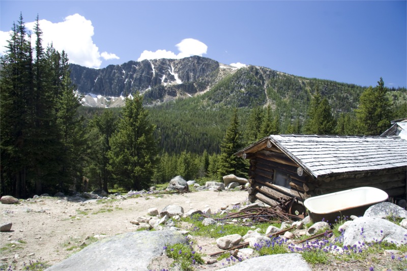
The mine had two main cabins – a smaller on with an drum-stove and a larger one with more amenities.

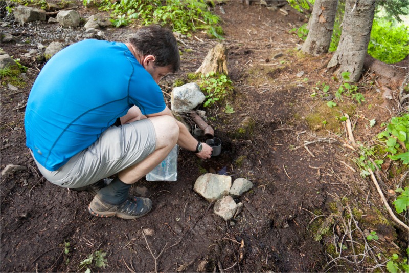
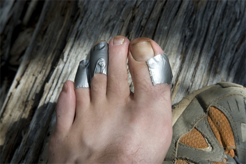
Nigel and I headed for the small one while Tim and Bill searched for water to treat. I had to sit – my blisters were excruciating now. I looked at the damage – and it wasn't pretty – both heels had quarter-sized water pockets forming – owch – we still have a long way to go.

We explored both of the cabins and then wandered down the hill to explore the mining area. The views of Apex Mountain from the mine shaft opening were spectacular. I can think of worse places to work each day.

For more details on Tungsten Mine, Nigel has an excellent write up here.

The only sad part for me about the mine area, was all the graffiti in the cabins. So many name carvings in the old logs. Some people have been more thoughtful and carved on wood plaques and hung them instead, but not nearly enough.

I was also shocked (no pun intended) to see remnants of Knob & Tube electrical wiring. I was surprised that they would have electricity all the way out here.

After several hours of exploring the mine, we started to move on. The guide suggested that water was scarce between the mine and cathedral lakes; so we loaded up all of our Platys at the Mine. Nigel and I rock-paper-scissored for who carried the water load. Nigel won.

A half mile from the mine, I was trailing behind the pack – wobbling slowly on sore blisters. Nigel took pity on me and ended up taking the water load anyway.

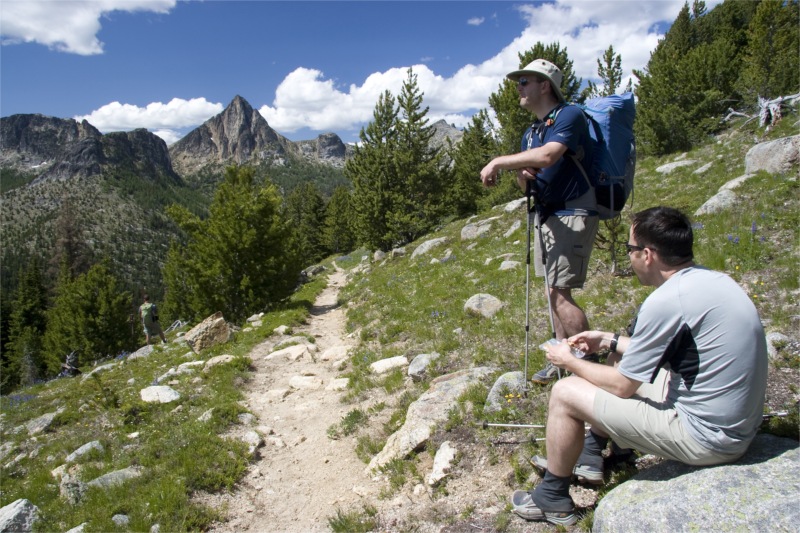
The trail between the mine and Cathedral pass is stunning. A miles or so after the mine the trail enters some wide open meadows around Apex pass. The back of Apex Mountain sweeps away into the distance – reminiscent of Annapurna or the back of Half-Dome. Larch trees are abundant here and it makes us want to come back and do this trail in the fall – to see all the leaves in their golden glory.

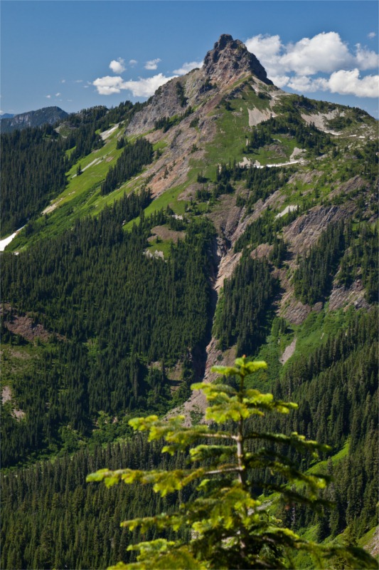
As we hike on, the views of Cathedral Peak become ever more impressive – revealing a deep vertical fissure down the center which is still harboring snow.

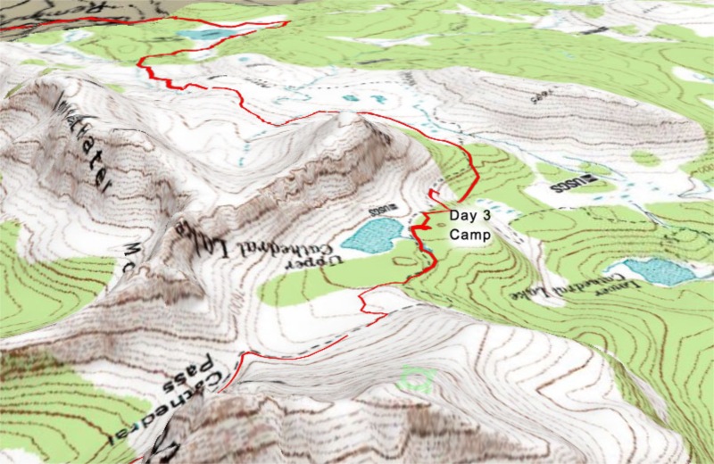
About a half mile from the pass, the trails passes an unusual granite band that cuts deep into the hillside. The area we cross it has a good water source that appeared like it would still be around in later summer.

The last stretch climbed gently to the pass and looking down into the valley below Рthere were many meadow openings in the trees, which made it appear like a well manicured golf-course, with huge granite slab for additional d̩cor.

A few final switchbacks and we were at the saddle of Cathedral Pass. The wind whipped up and howled around us here, so out came some layers. We could see a long way into the distance – all the way to Windy Peak. We wondered if they mis-named it – and we were standing on Windy Peak instead.

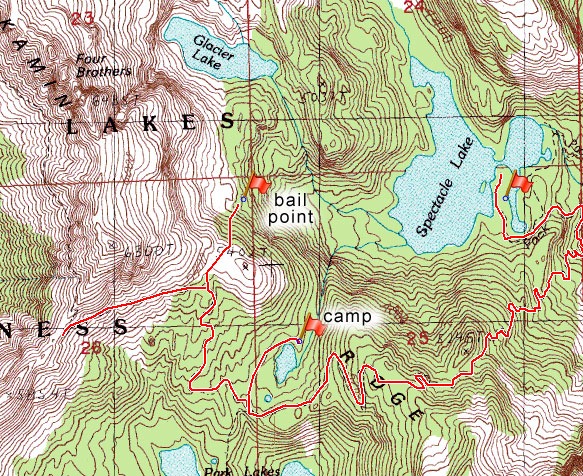
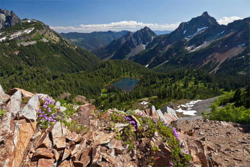
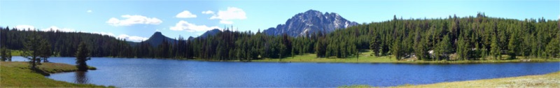
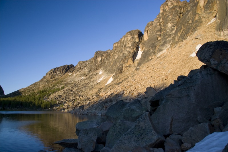
Down into the other side of the saddle we could see Upper Cathedral Lake, back-dropped by huge cliffs and a small shallow melt-pool / pond to its upper right.

After a rest and photo opportunities at the Saddle, we wandered down into the Cathedral area. We were giddy with excitement for how pretty it was and knowing we had almost accomplished another solid day on the trail.

We stopped at the pool to check it out – it was shallow – maybe two feet at best with a muddy bottom. It was also apparently a breeding ground for mozzies – as there was a lot of Lava floating on the surface – which swam down into the pool if the surface was disturbed with a pole.

After sticking our feet in – it didn't feel too cold – so we decided to take a little dip. I leaped in first, followed by Nigel and then Tim. Bill wasn't going to fall for it – he knew all too well that the mozzies love him – and would likely be eaten alive if he got so exposed.

I can't think of anything more invigorating for the body and soul than dipping in a cold mountain lake after a few days of backpacking. Outstanding!

After drying out in the sun – we put out gear back on and head down to the main lake to find camp spots.

The camp sites along the shore of the lake were closed for restoration, so we ended up camping in what appeared to be a horse camp up on a slight hill – with peek-a-boo views of the lake.

We had not passed another sole all day – and were the only people camped at the lake. Hard to imagine on a year were there are little other places to hike (due to lingering snow) and it being well into summer.

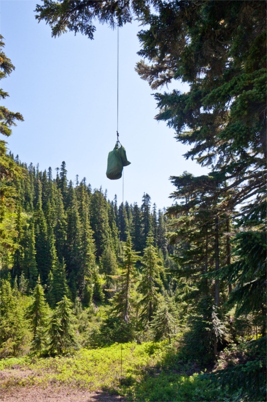
We ate a fine dinner – hung our bags, and chilled by the lake watching the sun go down. As the sun dipped, it lit up the cliffs by the lake with warm orange hues and lingering shadows. The trout leaping out of the lake and breaking the silence with their splashes only added to the ambience.

After the light faded over the lake – Tim and Bill found a great spot high up the rocky scree where they could see the rest of the sunset in the other side of the valley down into lower Cathedral Lake and the mountain in the distance.

Total distance for the day: 14.7 miles.

[Oh yeah – Tim gets all the credit for the outstanding photos and the team-player  award for lugging in his Canon 20D.]

East Pasayten Loop – Day 2

East Pasayten Loop – Day 4
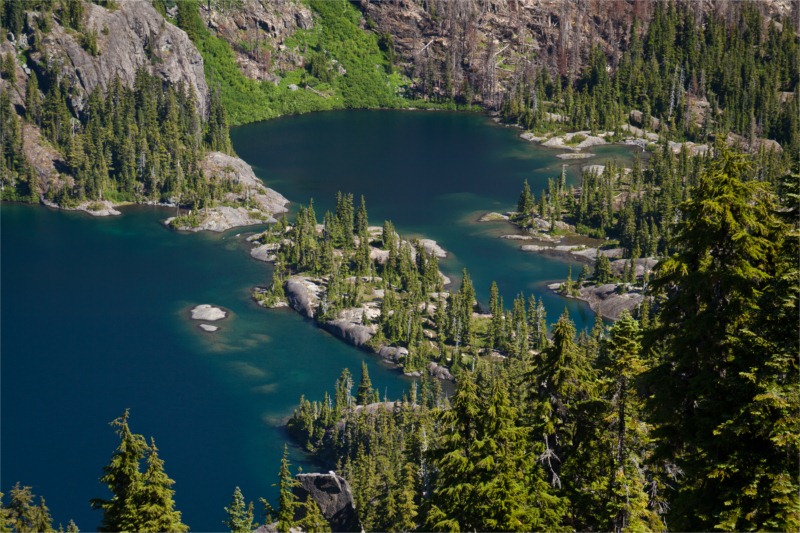
East Pasayten Loop Trip Report – Day 2

We awoke to blue skies and a soggy layer of condensation on the Tarptent. I blame the internal moisture from last night entirely on Nigel's snoring. All I can add is that I sure am glad I packed ear-plugs.

Breakfast today was an interesting affair. We had two competing meals: Team A (Bill & Tim) entered the "coff-meal" while Team B (Brett & Nigel) entered "Granola with fresh blue-berries and coconut milk". "coff-meal" was Tims invention – it consisted of instant oatmeal mixed with instant espresso in a zip-lock bag. I can't vouch for the coff-meal – but the Granola / coconut milk was a hit. Even Nigel was impressed – which takes some doing give that he's a guru Thai-Chef.

We hit the trail at about 7:30am. The trail soon passed a turn on the left up Fire Creek trail. The route in the normal guide book takes this direction and fords the Chewack River. We chose to do the hike in reverse for a few reasons: a) we wanted to save the best for last and gradually work our way into Cathedral Lakes and b) we were told there was still snow at upper Cathedral and an extra few days of melt-out would be in our favour, and c) Fire Creek was heavily burned out and has not been maintained. The crossing of the Chewack didn't look that bad – but it looked knee-deep in places. The ruin of an old shelter could be seen on the other side of the bank.

Continue reading

East Pasayten Loop Trip Report – Day 1

Trail Name: Eastern Pasayten Loop

Distance: 65-70 miles, round trip

Elevation Gain: 10,000+ ft

Date of Trip: July 13th – 16th, 2008 (3.5 Days)

Permit Info: An overnight permit is required, but can be obtained from the Trailhead; no advanced reservations necessary. Northwest forest pass required for parking.

Getting There: From Seattle, take I5N 62 miles to Highway 20 (Exit 230), then east 128 miles to Winthrop. At Winthrop, turn North on West Chewack River Road which becomes FR #51 a (Amazingly well maintained) gravel road. Follow the main road all the way to the end – at Thirtymile Camp.

Trail Map:

trailmap

Map from Backpacking Washington.

Don't forget to click on the thumbnails to see larger images!

Pre-Trip Notes:

We chose this trip due to a heavy snow-year in the Seattle area. In early July 2008 most trails that would be open were not accessible due to a heavy lingering snow-pack. The Pasayten Wilderness area in Eastern Washington melts out early and is amazingly void of crowds.

Day 1: (July 13th, 2008)

We left Seattle at about 8:15am. As we loaded up the packs into the back of Tim's land cruiser I noticed all of the Platypus Hoses hanging out: "Make sure you water doesn't leak" I quipped.

The drive was both beautiful and fast – it's a very pretty drive through the mountain passes to Winthrop. We arrived at Winthrop around noon. Our target destination was the Brew Pub for lunch. Sadly it was closed due to renovation – so off we went to the duck inn for Mexican food and beer.

Follow the link below for the rest of this report.

Continue reading

Camelback Mountain, AZ

Theresa and I spent last week in Arizona. Her belly is getting bigger and she wanted a little relaxation time before our new addition arrives in August.

I've never been to Arizona before, nor spent much time in a desert (I don't think Vegas counts), so it was quite the culture shock to see all the giant cacti everywhere and feel the heat.  We stayed near Camelback Mountain and I decided to do a little day hiking while I was there to explore a little.

There are several trails on Camelback that are very short, but fun none the less.

On Saturday I decided to take the Echo Canyon trail to the summit. It's a very short 2.4 mi (round-trip) trail with about 1,200 ft of gain. I normally enjoy a little solitude when hiking – so decided to avoid the crowds and be on the trail at 5:30 am. Boy was I in for a surprise!

At 5:20 am, I arrived at the trailhead to find the car park jam packed.

The trail starts out easy enough with large log steps leading the way on the trail. The scenery here is stunning with incredible reddish rock formations off to the side.

The beauty of the boulders made me wish I had a pair of rock boots and a chalk bag with me, and I could dwindle a few hours bouldering around.

On the way up I passed by a large 12 foot cactus that was flowering. The flowers were swarming with bees hard at work.

The trail climbed quickly up towards the ridge on the left. It soon leveled off and entered an area that was caged in with chain link fence. I assume to prevent people wandering off the steep side.

Immediately after the chain link was a 'hand rail' cemented into the rock to aid with the now steepening climb. The rock was passable without the handrail, but you needed to be confident of your footings.

I was amazed at both how crowded the trail was, and mused at how varied the trail goers were. I don't think I have been on a trail this crowded in the Pacific Northwest – I must have passed a different person every 50 yards or so – either coming down, or slowly moving up.

The crowd made for great people watching – there were serious hikers with Camelbaks and heavy boots, there were trail runners doing a 3-trip laps – up and down – up and down, there were tourists with cameras that looked like they had just got off a tour bus, there were hip young couples wearing blue jeans, perfume and make-up. There was a man carrying a baby on his back and countless dogs. It's 5:40am for gods sake!!! Where did all these people come from??

After the second set of rails, a few twists and turns, the trail finally starts heading up the last seep section to the summit.

The views from which, were expansive and urban. The sprawl of Arizona spread out before me – mostly flat with the occasional rock burst jutting out of the ground. 

It took me about 35 minutes to reach the top and about 20 minutes to get back down again. It's a quick hike – but highly recommended if you are in the area. I have no idea when you would go to avoid the crowds – perhaps make it a mid-day hike with a mylar umbrella and an asbestos suit?

I have a new found respect for the chapter of Beyond Backpacking about hiking in the desert that I blissfully ignored before.

I didn't take my camera – so thanks to Cobalt123, TeechNosPos, Daniel Greene and phxpma for graciously sharing their flickr photos via Creative Commons.

Little Annapurna Day hike

Trail Name: Little Annapurna

Distance: 15 miles, round trip

Elevation Gain: 5,200 ft

High Point: 8,440 ft

Trip Date: Aug 12th, 2007

Permits: Very restrictive over-night permits. A few are available by on-the-day lottery. See here for permit info. Day-use only permit available at trailhead.

Getting There: From Seattle – take Highway 2 east to Leavenworth. As you enter the town – turn right on Icicle Road. At 8.5 miles, turn left onto FR 7601 and follow it 3.7 bumpy miles to the Stuart Lake trailhead parking lot.

Read on for full trip report…

Continue reading

West Coast Trail Trip Report – Day 5

A Quick Stroll Around Green Lake.

B: "Wake up – Wake up! It's sunny! It's sunny!"

T: "Ugh… it's 5:45am – go back to sleep."

15 minutes later, and Theresa caved in. We were up and about camp for an early start, and the skies were indeed blue.

We ate a good breakfast, some nice hot coffee, packed up our bags for the last time and were on the trail by 7:30am. Last last 12 km – "a quick walk around green lake", right?

Continue reading