Google just recently launched their "Terrain" overlay. Microsoft has had one for
a while over at maps.live.com, but I like Googles version better. It's cleaner and more detailed.
I wonder if someone will create a website where hikers can start plotting out trails using a combination of the Google My Maps and Terrain features.
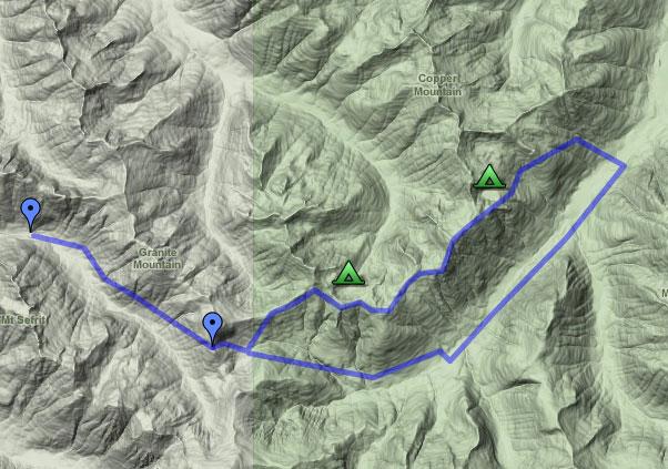
Here's a quick sample one I whipped up for Copper Ridge Loop: Copper Ridge Loop Map.
Something like this for all the hikes in the US, with clickable pushpins showing photos at that view point. How cool would that be?
Heck – I'd even go a step further and allow people to collaborate photos taken from the same view point, combined with Photosynth to give a 360 degree view.
Ha! An excellent choice for a quick sample, Brett. I was hiking right there this summer while in the midst of my PNT thru hike. It’s ironic you chose this section, as I was just cruising over this area in Google Earth this evening as well. Nice work on the loop.
– Sam
Brett, love how one can see the ‘depth’ of a hike now. I love for instance 3D Topo and love looking at Google Earth and flying over a trail and seeing the actual pesky elevation. That loop you show is so gorgeous though. I haven’t been on that trail in 5 years, I need to get back!