East Pasayten Loop Trip Report – Day 2

We awoke to blue skies and a soggy layer of condensation on the Tarptent. I blame the internal moisture from last night entirely on Nigel's snoring. All I can add is that I sure am glad I packed ear-plugs.

Breakfast today was an interesting affair. We had two competing meals: Team A (Bill & Tim) entered the "coff-meal" while Team B (Brett & Nigel) entered "Granola with fresh blue-berries and coconut milk". "coff-meal" was Tims invention – it consisted of instant oatmeal mixed with instant espresso in a zip-lock bag. I can't vouch for the coff-meal – but the Granola / coconut milk was a hit. Even Nigel was impressed – which takes some doing give that he's a guru Thai-Chef.

We hit the trail at about 7:30am. The trail soon passed a turn on the left up Fire Creek trail. The route in the normal guide book takes this direction and fords the Chewack River. We chose to do the hike in reverse for a few reasons: a) we wanted to save the best for last and gradually work our way into Cathedral Lakes and b) we were told there was still snow at upper Cathedral and an extra few days of melt-out would be in our favour, and c) Fire Creek was heavily burned out and has not been maintained. The crossing of the Chewack didn't look that bad – but it looked knee-deep in places. The ruin of an old shelter could be seen on the other side of the bank.

Continue reading

East Pasayten Loop Trip Report – Day 1

Trail Name: Eastern Pasayten Loop

Distance: 65-70 miles, round trip

Elevation Gain: 10,000+ ft

Date of Trip: July 13th – 16th, 2008 (3.5 Days)

Permit Info: An overnight permit is required, but can be obtained from the Trailhead; no advanced reservations necessary. Northwest forest pass required for parking.

Getting There: From Seattle, take I5N 62 miles to Highway 20 (Exit 230), then east 128 miles to Winthrop. At Winthrop, turn North on West Chewack River Road which becomes FR #51 a (Amazingly well maintained) gravel road. Follow the main road all the way to the end – at Thirtymile Camp.

Trail Map:

trailmap

Map from Backpacking Washington.

Don't forget to click on the thumbnails to see larger images!

Pre-Trip Notes:

We chose this trip due to a heavy snow-year in the Seattle area. In early July 2008 most trails that would be open were not accessible due to a heavy lingering snow-pack. The Pasayten Wilderness area in Eastern Washington melts out early and is amazingly void of crowds.

Day 1: (July 13th, 2008)

We left Seattle at about 8:15am. As we loaded up the packs into the back of Tim's land cruiser I noticed all of the Platypus Hoses hanging out: "Make sure you water doesn't leak" I quipped.

The drive was both beautiful and fast – it's a very pretty drive through the mountain passes to Winthrop. We arrived at Winthrop around noon. Our target destination was the Brew Pub for lunch. Sadly it was closed due to renovation – so off we went to the duck inn for Mexican food and beer.

Follow the link below for the rest of this report.

Continue reading

Weight: 6lbs 14 oz

Sounds heavy – but this newest addition to my backpack is worth every ounce in carrying with me.

Chester Morgan Marl was born last night weighing in at 6 lbs 14 oz. Theresa did an amazing job of delivering him with a natural birth at Swedish hospital.

I've seen Theresa do some pretty amazing things – like 50 miles of mud, roots and ladders on the West Coast Trail or rock climbing Devils Tower – but her stamina for 22 hrs of drug-free labor blew me away. I'm in awe.

His name is in honour of my birthplace (Chester, UK) and because we think it's cool.

More Pics at http://chestermorgan.smugmug.com

Chia Seed for Backpacking

chia2.jjpg

Chia Seeds. Yes, this is indeed what Chia Pets are made of. Not having grown up in America, I can't verify this first-hand, but those are the rumours.

"…and its relevance to ultralight backpacking" I hear you ask? Patience grasshopper, we'll get there…

First let me tell you the story of how I learned about Chia Seeds… In search of a better dried milk product for my breakfasts (with more fat content), I heard of a Nestle product called Nido that is common in Spain/Mexico. Unlike typical non-fat dried milk found in the likes of Whole Foods in the US, Nido is whole-milk. My search led me to a Latin Grocery shop in Pike Place Market.

Sadly they were out of stock of Nido, but while there I got chatting with the nice lady that owns the shop and quickly onto the topic of backpacking. Her eyes opened wide with excitement as I told her about traveling light weight. "Oh my", she said "You have to try Chia Seeds. They are a miracle and are perfect for what you talk of." … "Aztec warriors used to march for an entire day on just a handful of seeds.". (Now probably wasn't the time to mention that my recollection of Aztec history is that they died out due to hunger and Spaniards). She went on to tell me how long distance runners and STP cyclists come to her shop to buy these precious seeds.

I was admittedly quite intrigued. So what are the proclaimed benefits of Chia Seeds? According to thechiaseed.com:

1. Nutritious. Full of omega-3, antioxidants, calcium, protein, fiber, and many other vitamins & minerals.

2. Energizing. Gives an energy that lasts, providing stamina and endurance.

3. Reduce Cravings. Because Chia Seeds absorb so much water and have high soluble fiber levels, they help release natural, unrefined carbohydrate energy slowly into the bloodstream.

So how do I prepare them? At breakfast – I simply fill a 2-cup pot with water… add a Tbsp or so of dried coconut milk (for flavor and fat-boost) and then dump in about 1-2 Tbsp of seeds. Wait 5-10 minutes and drink. Waiting is important – over time the seeds absorb the water and puff up into small balls almost like mini tapioca balls in Bubble Tea.

I've used them with much success on the West Coast Trail and also in our recent Pasayten hike. Both Nigel and I used them two out of three mornings on the Pasayten trip. We both experienced feeling a lot more hydrated in the mornings and also in need of less mid-morning food. Our breakfast sustained up well beyond lunch time with strenuous hiking.

Wine To Go!

Thankfully Germany is more evolved in some ways than America. Not least of which is with their more relaxed attitudes towards alcohol.

Katadyn makes dehydrated red wine powder for backpacking. Sounds too good to be true… take a a little glacier melt water, warm up to room temperature, stir and mix with the powder… and presto! You have a glass of red wine with 8.2% alcohol content.

No more lugging those heavy bottles in, Jeanne.

I'm bet it's no Leonetti, but I sure want to give it a try to see how bad it tastes.

Thanks to the FDA… only available for shipment in the EU.

Terra Nova Titanium 2G Skewers

I was in Pro Mountain Sports this evening with Tim picking up a few things. skewer
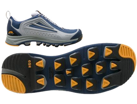
One thing that caught my eye was some crazy small and light tent pegs.

The Terra Nova Titanium 2G Skewers. 2G as they weigh only 2 grams each. I weighed the pegs that came with my cloudburst. There are four of them, and together they weigh 1.6oz. Four of these guys are only 0.3 oz.

Seems like a possibly interesting trade in the future. Worthy of a field test one weekend perhaps. I suspect the holding power is a lot less, but reinforced with a nearby rock they might be just fine.

Pack of 6 is $20. I've only seen them on UK based web sites so far.

Tim also picked up a LiteMax stove, which he's planning on bringing on our trip. Should be a good field test.

Defending against Mosquitoes

I called the ranger station to check on conditions for the Pasayten Wilderness area we are hiking in this weekend. Among other things I asked if the bugs were a nuisance this time of year. She chuckled and said "Reports are coming in that Mosquitos are being assigned to individual hikers by the cloud full."

That doesn't sound pleasant. So what defenses am I taking?

bug.defense

  1. First line of defense will be clothing repellant. It's going to be hot and my thin t-shirts are no defense for mozzies. I'm going to treat my shorts and T-shirts with Sawyer Spray on Repellant.
  2. My second line of defense is for my exposed skin. I'd rather stay away from DEET unless I really need it. I'm going to need to wear sunscreen on my exposed skin anyway – so why not combine it with a light repellant. Avon Bug Guard is SPF 30 and claims to keep the bugs away. It has rave reviews on epinions, so we shall see how true they are… I'll take a repackaged 2 oz container.
  3. My third line of defense is for when the clouds swarm and the other defenses fail. Out comes the Ultrathon 34% DEET. Again, 2 oz should be plenty.
  4. And finally… when when I'm in camp and wanting to cook without being bugged… an ultralight mosquito net at 0.3 oz.

Old wives tales have it that some people are more attractive to Mosquitoes than others. Bill claims to be one of those people, which makes the rest of us happy 🙂

Go Bill – taking one for the team.

My Bear Bagging Kit

No, it's not for bagging bears. It's for bagging up your food to keep out of reach of bears. Or raccoons, chipmunks, other hungry hikers etc.

I've refined this over the years taking feedback from other hikers and what I glean off forums etc. 

bearbagging

The kit comprises of a few key items:

Total weight for everything 1.3 oz.

The gossamer gear spectra line is flat vs round. This makes it safer when hanging heavy food bags in trees as it glides over limbs without ’sawing’ into them

The kit makes it easy to perform the "PCT Method" of hanging food bags. Follow the link for detailed instructions on how to use this method.

Tip: The article shows how you use a twig or stick in the field to tie a clove hitch around. I find with heavy bags it's hard to undo the hitch in the morning. One option is to break the stick – another is to bring a small section of chopstick. It's strong enough to hold the load and tapered so that it slides off easily in the morning.

Eastern Pasayten Loop

Barring some freak 10-foot snow-melting heat wave in the next week, we've officially selected a backup hike to replace our Wonderland trip.

east-pasaytenWe considered two hikes in the Pasayten Wilderness area: Eastern Pasayten Loop and Larch Pass/Hidden Lakes.

The Eastern Pasayten Loop is it. It's a 65 mile loop that covers what appears to be some spectacular terrain.

Nigel called the local ranger station to get some trail updates. Here is what we learned:

– Currently a trail crew is working on clearing the trail and is moving from the East Fork moving West

– Start of trail #510 still has trees down and standing water in the parking area. They plan on opening the trail head by the end of this week .

– Fire Creek burned out in 2003 and is still a big mess – she said to avoid it since it has not been maintained since.   South of this is supposedly ok (especially the area around Four Point Lake)

A web page of snow conditions for each of the trails located here. Just last week it sounded like heavy snow still – today they are listed as snow free for the trails on Eastern Pasayten but heavy snow at Larch Pass still.

Map and trail guides courtesy of Backpacking Washington, available from Amazon for $13.46.

Ultralight Pillow?

OK.. so we established that my dentist Bob likes a Pillow

So what are the options for other hikers with a pillow fetish?

Bob mentions the Montbell UL Comfort System Pillow, which at 2.3 oz might be a pretty good nights sleep.

But can Bob (remember this is the same guy that saws off the extra length on the Titanium bolts on his race-car) do better? Sure he can…

The FlexAir Ultralight pillow. Totally waterproof and at 0.56 oz gives Bob a whopping 1.74 oz refund. Not to mention the $20 of so in savings, as these puppies run $6.29 for a 3-pack.

I actually did try the FlexAir on our Rampart Lake hike – it faired pretty well, although needed to be slightly deflated for the most comfort.

These days I'm back to the old stuff-sack of spare clothes approach and pretty happy with it. Give me a few Tylenol PMs and a flimsy torso pad and I'm a happy camper.

Wait! Doesn't Tylenol cause tooth decay? Oh no – that's Methadone, never mind…

Satellite Communications

Theresa is due in early August. As we leave on July 12th for our trip, there is a very small chance that she might go into labor early. It's unlikely enough that we both feel comfortable about me going on the trip still. That said, I want a way for her to get in touch with me on the trail if the need arises, so I could evacuate the hike and get to the hospital as soon as possible.

geocomms

So what are my options? I've been looking into a few:

1. The  Spot Satellite Messenger.

This is an interesting little device. That allows for backpackers to send a distress call. When activated, the unit broadcasts it's own GPS location every ten seconds together with a distress signal. The distress signal can be "OK, Send Help, or Emergency" based on the buttons on front. Friends can track your spot beacon online and see where you are and that you are OK. Available from findmespot.com. It weighs in at 7.4 oz and can run for 14 days on standby and 7 days when broadcasting.

Not very useful for my situation as Theresa has no way of communicating to me. It's outbound broadcast only, no receive capability.

2. Satellite Phone.

Satellite phones don't require typical cellular tower coverage as they use orbiting satellites to communicate. For best coverage you need a network that uses low orbit Satellites. There are two gigs in town for the US. Globalstar and Iridium.

The Iridium 9505 handset can be rented for about $40 / week but is heavy at 13 oz. It only has 3 hrs of talk time and 30 hrs on standby.

The Gobalstar GSP-1700 is better at 7 oz but rental rates are in the $100 / week range.

The standby time makes this less than ideal for me. I would have to arrange a few key times of the day to either call Theresa, or have the phone on waiting for an inbound call.

3. Satellite Pager

Also running on the Iridium network is the Motorolla 9501 Satellite Pager. It receives inbound text messages up to 160 characters. The messages can be sent easily via Theresa from a website.

It's the lightest option at 4.16 oz and has a standby time of an incredible 30 days! It also runs on a single AA battery so it's field-replaceable for any PCT'ers looking to getting encouragement from home.

Rentals are available from http://www.gitsat.com/. Their rental rates are quite reasonable at $25 / week. However they do stiff you on shipping at $50 to and from your home.

Pasayten Boundary Trail

We're searching for a replacement hike for our Wonderland Trail trip. So far we have narrowed the search down to 3 candidates:

  1. A section of the PCT in Northern California (JMT maybe)
  2. Olympic Coast
  3. Boundary Trail

1 is challenged for us logistically at such short notice. 2 sounds fun – but too similar to our WCT experience last year and probably not "epic" enough. 🙂

3 is an interesting candidate. Its way out in the wilderness, with Grizzlies and Gray Wolves, and best of all – mostly snow free (so we believe). Sounds entertaining…

Length: 98.0 miles
Difficulty: Very Difficult
Overall rating: 10
Season: This trail is accessible July-September.

Boundary Trail is located in Okanogan National Forest.

Links:

nwsource Review

twohikers.org

Time to study the maps and see if we can make a loop out of it. With 6-7 hrs drive from Seattle, travel time will whittle our trail time down a little.

Field-Charging a USB device

I finally caved and bought a Garmin Forerunner 405 (more on that later). Its form factor is nice and small, but it only carries a day worth of GPS power. On a long trip, I would need a way to recharge it in the field.

juicyEnter the Minty Boost. The Internet is fortunately fully of smart EEE majors who have a fetish for building stuff in Altoids tins. The Minty Boost is one of such creations. It allows a USB device to be charged from a couple of AA batteries.

The DIY kit is available from Adafruit for $19.50.

I might just get one, and whip out the old soldering iron and see what I can assemble in a half hour.

I'll post my results of how well it charges the Forerunner once I know more 🙂

Wonderland Woes

We are almost three weeks away from the start of our Wonderland permit.

Things aren't looking good for us. The trail is still buried under the heavy snows from this season.

All of our designated camp sites have 100% snow cover still.

I'm holding off on calling the ranger station for fear of disappointment hearing him laugh at me on the other end of the phone, when I ask how likely will it be hikeable by July 12th.

Sarah posted a scary (to me) video today showing the current snow pack conditions.

Trail conditions can be found here.

We're starting to evaluate alternatives. Hike the Olympic coast? Hop a plane to California and hike the John Muir trail?

Ultralight GPS Units

I don't normally bother with a GPS. It doesn't quite fit my ultralight principles. The extra few ounces that I could live without – as I would not leave map and compass at home.

However, Backpacker Magazine is looking for volunteers to help gather some mapping data and write-up trail guides/accounts. I agreed to do this for the our Wonderland Trail hike in July. To do so, I need to bring a GPS to track coordinates and record way points.

gps

So what do I buy? Here's my criteria:

– As light as possible.

– Can log up-to 10 days or 100 miles of data.

– Has enough battery life for 10 days.

– Altimeter

I don't care about maps and fancy color screens. Lithium Ion rechargeable models are obviously out due to lack of recharge ability.

After a bit of digging around, it looks like the Garmin Geko 301 is coming up trumps.

It weighs just 3.1 oz with batteries – and has a run-time of 12 hrs on two AAA's. We will be planning a few resupply points – so shipping in some extra batteries should be no worries. Retails for $246.

If anyone has a better idea, I'd love to hear it…

Mt. Rainier Tragedy

A local climber from Bellevue died on Mt. Rainier yesterday getting trapped in a blizzard on his way down from Camp Muir.

Camp Muir is normally a simple non-technical climb, but it sounds like the blizzard created five foot snow drifts and strong winds.

It's a sad loss indeed.

Blizzards in June?! A sobering reminder on unpredictable weather as we gear up for our Wonderland hike next month.

Full article on King 5 news.

Bottle Cap Tripod

Have a bottle of water, or a full Platypus? Add this little gizmo – and presto – instant tripod.

For a whopping ten bucks from here, it's a bit like day light robbery – but I'm sure the boys over at BPL have own MYOG version for less.

Weight? I have no idea… I can't justify the $10 plus shipping to find out, but it looks pretty light and seemed worth a mention.

GoLite Storm Dragon

We're starting to think about our Wonderland Trip in July. Nigel (Our ultralight newbie) has been looking into footwear. He settled on the Golite Storm Dragons.

The seem to be a beefed up version of the Sun Dragon – with the nice feature of having a built-in gaiter system. Nigel picked these, as we will likely have a lot of snow ridges to cross and the gaiters will make it a little more pleasant.

I paired my Sun Dragons with an add-on set of gaiters which worked very well in sand.

I'll be curious to see how these work out for Nigel.